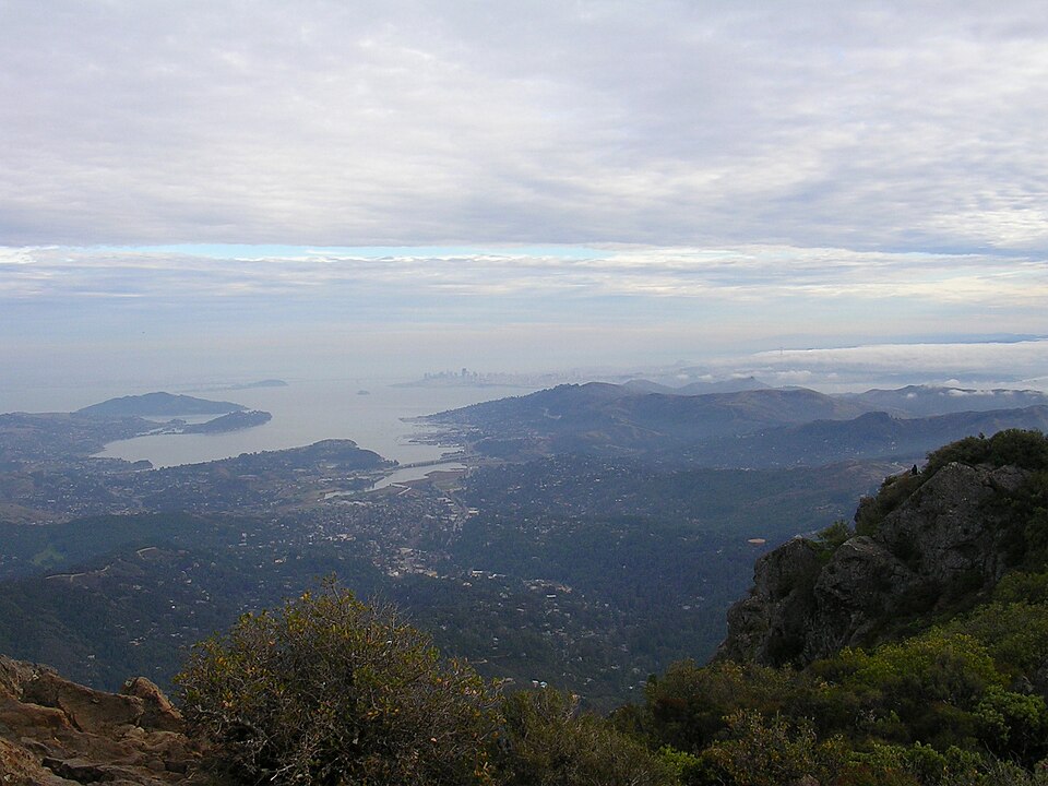
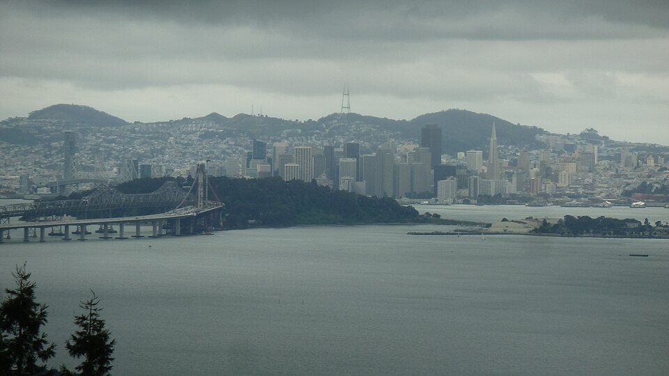
Geology and Landscape
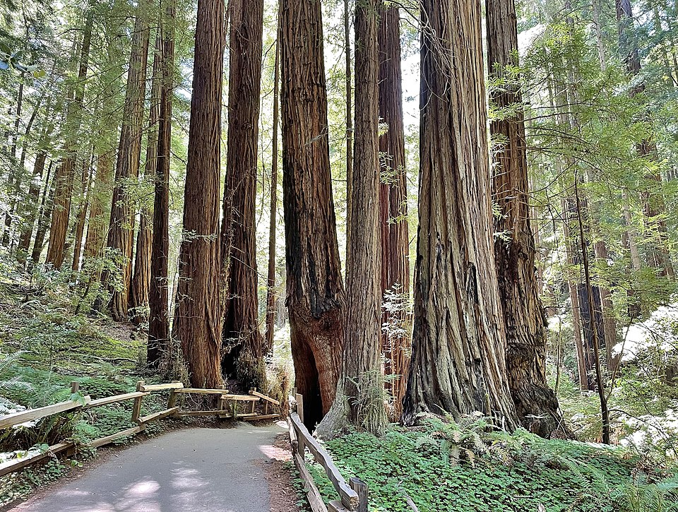
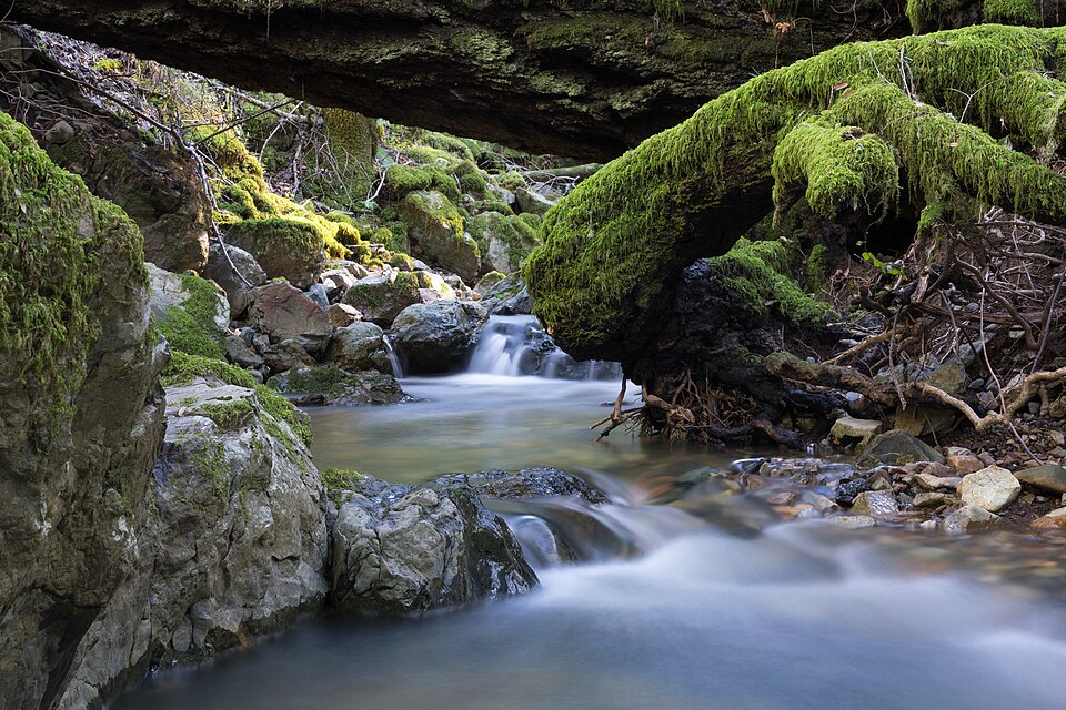
Mount Tamalpais is part of the Coast Ranges, a series of mountain ranges running along the California coast. The mountain is made up primarily of Franciscan chert, serpentinite, and sandstone, rocks that formed on the ocean floor millions of years ago and were pushed upward by the collision of the Pacific and North American tectonic plates. The landscape includes grassy hilltops, dense redwood canyons, oak woodlands, and chaparral-covered slopes. Cataract Creek, one of the mountain’s most popular natural features, tumbles down a series of waterfalls on the northwest face during the rainy season.
The Coast Miwok People
Long before European settlers arrived, the Coast Miwok people lived in the lands around Mount Tamalpais for thousands of years. The mountain held spiritual significance for the Miwok, and many historians believe the name “Tamalpais” comes from the Miwok language, though the exact meaning is debated. Some scholars suggest it may mean “coast mountain” or “west hill.” The Miwok hunted deer, gathered acorns, and fished in the streams that flow down the mountain’s slopes. Their deep knowledge of the land helped them thrive in the diverse ecosystems of Marin County.
The Mount Tamalpais Railway
In 1896, the Mount Tamalpais and Muir Woods Railway opened, carrying passengers from Mill Valley to a tavern near the summit. The 8.19-mile track featured 281 curves, earning it the nickname “The Crookedest Railroad in the World.” Passengers could ride open-air gravity cars that coasted downhill on the return trip, reaching speeds of about 12 miles per hour with only a brakeman to control them. The railway operated until 1930, when automobiles and a new road to the summit made it less popular. Today, the Old Railroad Grade trail follows much of the original route and is one of the most beloved hiking and biking paths on the mountain.
Birthplace of Mountain Biking
Mount Tamalpais is widely considered the birthplace of modern mountain biking. In the mid-1970s, a group of cycling enthusiasts in Marin County began modifying old cruiser bikes with stronger brakes and wider tires to race down the mountain’s steep fire roads. These riders, including Gary Fisher, Joe Breeze, and Charlie Kelly, organized a famous downhill race called the Repack, named because riders had to repack their coaster-brake hubs with grease after each run. Their experiments led to the development of purpose-built mountain bikes, which became a worldwide sport and recreation activity by the 1980s. A historical marker on the mountain commemorates this legacy.
Wildlife and Ecosystems
The mountain’s varied terrain supports a wide range of wildlife. Black-tailed deer, gray foxes, coyotes, and bobcats roam the hillsides. Red-tailed hawks and turkey vultures circle above the grasslands, while great horned owls hunt in the forests at night. The redwood groves on the southern slopes, including the famous Muir Woods, shelter endangered coho salmon in their creeks. More than 750 species of plants grow on Mount Tamalpais, including rare Marin manzanita and Tiburon mariposa lily, which are found almost nowhere else on Earth.
The State Park Today
Mount Tamalpais State Park was established in 1930 and attracts over two million visitors per year. The park connects to a larger network of protected lands, including Muir Woods National Monument, the Marin Municipal Water District watershed, and the Golden Gate National Recreation Area. Together, these areas protect more than 50,000 acres of open space. The park offers over 60 miles of trails for hiking, running, and cycling. The Mountain Theater, a natural stone amphitheater near the summit built by the Civilian Conservation Corps in the 1930s, hosts outdoor plays and events each spring. Mount Tamalpais remains one of the most popular natural landmarks in the San Francisco Bay Area.